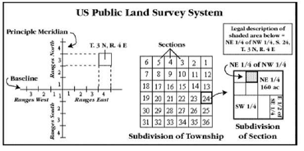
I have Mansour's book on Civil Surveying and borrowed Cuomo's book so that I get to work out some more problems. I saw that Cuomo's book had a chapter dedicated to Astronomical Observations which wasn't dealt in Mansour's book. I also saw Cuomo's book deal extensively with the California Coordinate System including mathematical problems, where as Mansour just dealt with definitions and terms. The US Public Lands System has been dealt extensively in both books.
My questions are as follows:
1. I looked at the test specifications available on the CA Board's website. http://www.bpelsg.ca.gov/applicants/plan_civsurvey.pdf . I did not see any explicit reference to Astronomical Observations. Am I missing something here or is that section redundant for the Civil Survey exam purposes?
2. I did not notice any reference to US Public Lands System but did see the following reference - "K46. Formats and terminology of legal descriptions as it applies to the Business and Professions Code 6731.1." Code 6731.1 defines the various activities that a Civil Engineer can practice and can't. The only thing that I have seen in topographic surveys that refers to Sections, Townships/Ranges etc. are in reference to easements. I have a basic understanding of the system but do I need to study it for the exam? Understanding something and being able to answer questions in a few minutes in an exam are two related but separate items in my mind.
3. California Coordinate System - Can this be interpreted as the requirements shown in the following item? " T14. Use of datums for horizontal and vertical control K48. Different types of horizontal datums K49. Different types of vertical datums (e.g., bench marks)". Basically, I am trying to figure out if I should study it thoroughly or just skim through.
Thank you for your help.
Last edited by a moderator:


